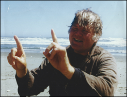
The 100,541-acre Bear Creek Watershed, including Ash Creek, is an eastside tributary of the Sacramento River in Shasta County. In 2002 a group of landowners and residents formed the Bear Creek Watershed Group (BCWG) with technical assistance from state and federal agency liaisons and watershed coordination from the Western Shasta Resource Conservation District (WSRCD). Stan and Carl Weidert were founding members of this watershed group.
The group’s mission is to “seek to promote a sustainable community, both human and biological, within the Bear Creek and Ash Creek watersheds.” The purpose of the BCWG is to:
• Promote a healthy, diverse resource–based local economy;
• Educate the community about the value of wise watershed management;
• Promote a safer watershed;
• Maintain and enhance the water quality, fisheries, wildlife and wildlife habitat of the watershed;
• Promote the removal of invasive exotic vegetation; and Preserve the rural characteristic of the watershed.
The BCWG oversaw the preparation of the Bear Creek Watershed Assessment and Bear Creek Watershed Management Strategy, completed in 2006 with grant funds awarded to the WSRCD.
In 2007 the BCWG was notified that they had approximately $9,700 to be used for a restoration project in the Bear Creek Watershed. Building on the existing conditions documented in the Bear Creek Watershed Assessment, and the restoration goals and objectives identified in the Management Strategy, the BCWG developed a project plan and purchased equipment to record diurnal stream temperatures, dissolved oxygen, pH, turbidity and electrical conductivity throughout the anadromous reaches of Bear Creek. The purpose of this data collection would be to establish a baseline of stream conditions for Bear Creek and identify portions of the creek that may be getting too warm to support salmon and steelhead.
In March 2011 the Restoration Project Team was ready to begin. The Team consisted of members of the BCWG, led first by Stan Weidert and later by Carl, and California Department of Fish and Wildlife (CDFW) Environmental Scientist Eda Eggeman. They selected nine monitoring locations from the top of the watershed to the confluence with the Sacramento River. Locations included one on the South Fork Bear Creek, two on the North Fork Bear Creek and seven on the main stem including one at the mouth. From 2011-2017 the BCWG collected temperature and water quality data and observed the flora and fauna of Bear Creek.
During our years of data collection, BCWG member Dick Rullman compiled all the temperature and water quality readings and field notes into tables and created a sizeable body of data. CDFW fisheries biologist Doug Killam also compiled the temperature data into a centralized CDFW database for Northern Region creeks. This baseline water quality information when analyzed will be used to determine aquatic habitat suitability for Chinook salmon and steelhead in Bear Creek.
The BCWG team will continue to install and download temperature loggers and take water quality readings for as long as there is interest and we are able. We will miss Carl’s leadership, his warm nature, and his extensive knowledge of our natural world. We will continue his efforts to convert everyone into watershed stewards! Thank you for everything, Carl.
Eda Eggeman Ebe, Environmental Scientist
California Department of Fish and Wildlife
January 2019